1
/
of
5
Ohio maps, braille, 3D printed
Ohio maps, braille, 3D printed
Regular price
$80.00 USD
Regular price
Sale price
$80.00 USD
Unit price
/
per
Shipping calculated at checkout.
Couldn't load pickup availability
Dimensions:
- Length: 210 mm (8.3 inches)
- Width: 210 mm (8.3 inches)
Material: white PLA (plastic)
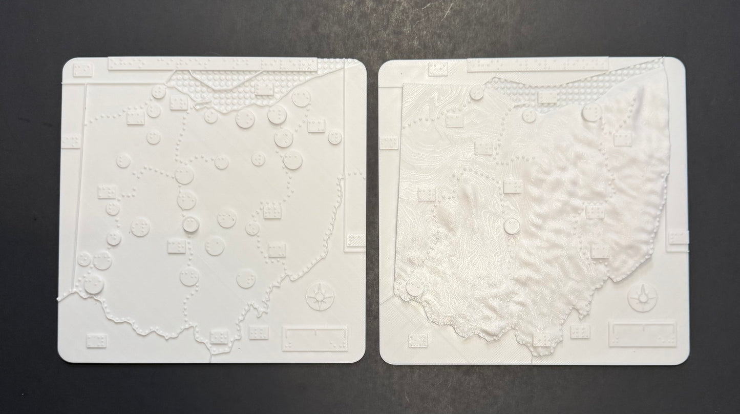
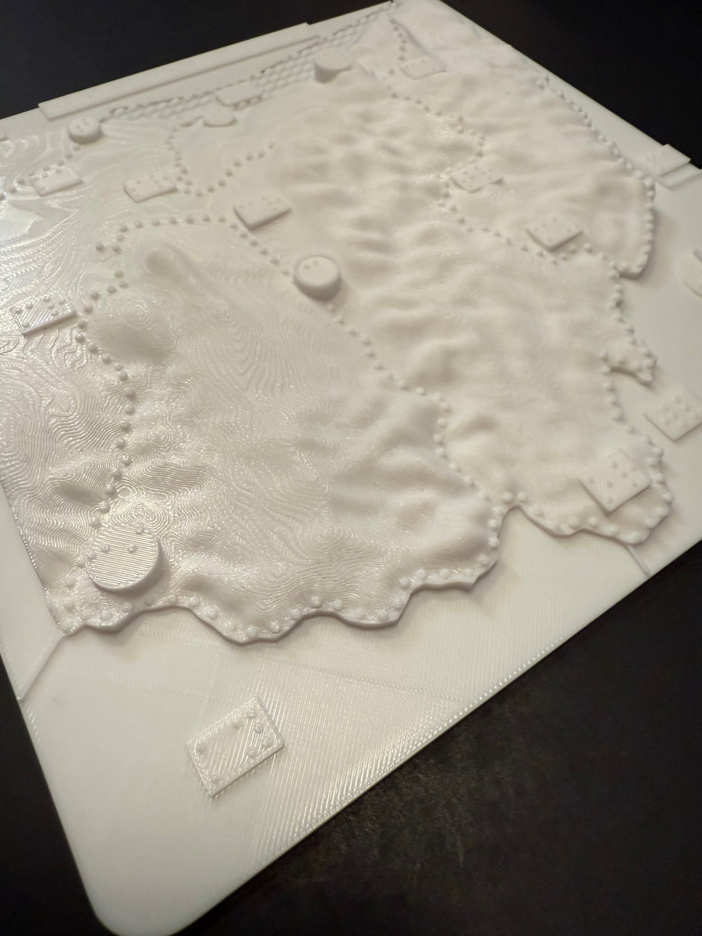
Braille 3D Map of Ohio – Tactile Set (2 Maps: Elevation & City Overview) Designed for blind and visually impaired users – fully tactile, no print
Enhance spatial understanding with this two-map tactile set representing the state of Ohio, crafted for accessibility, education, and exploration.
Set Includes two maps and a key:
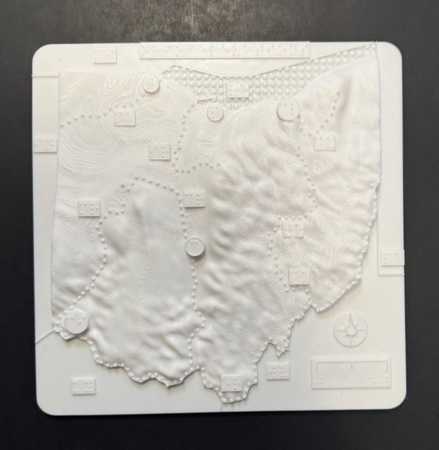
- Elevation and Geography Map:
- 3D tactile representation of Ohio’s elevations.
- Includes raised major cities, rivers, and topographic contours.
- Designed to convey changes in terrain across the state.
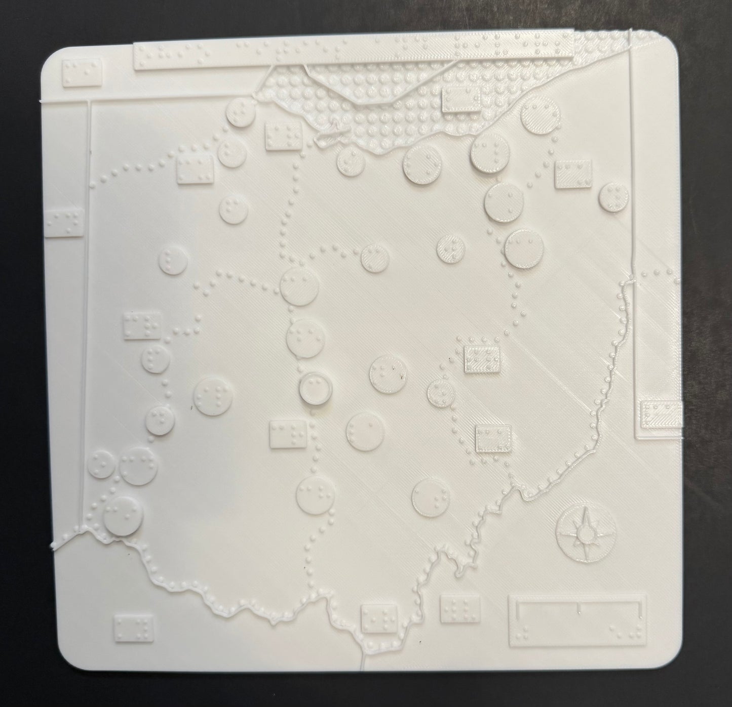
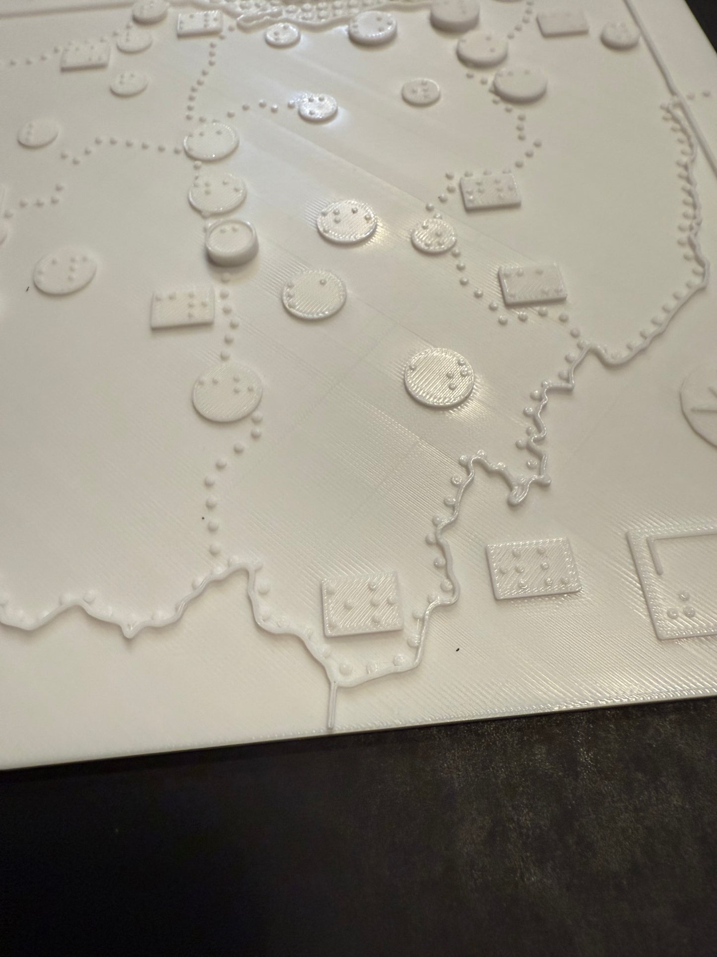
- City and Waterways Map:
- Detailed map showing Ohio’s cities (including smaller cities not on the elevation map).
- Features lakes and rivers
- Smooth, non-elevated background for clearer city and water detection.
- A braille sheet with map key
- Embossed Braille labels for cities and rivers
- Tactile symbols and textures distinguish between elevation, urban areas, and water.
Ideal for schools, orientation & mobility training, libraries, and home learning.
Made with high-resolution 3D printing and durable eco-friendly PLA plastic.
Made in collaboration with the Clovernook Center for the Blind and Visually Impaired. A portion of proceeds supports educational programs for blind and visually impaired youth.
"
Share