Uganda maps, braille, 3D printed
Uganda maps, braille, 3D printed
Couldn't load pickup availability
<p>Dimensions:</p><ul><li>Length: 209 mm (8.2 inches)</li><li>Width: 209 mm (8.2 inches)</li></ul>
"</hr>
<p>Material: white PLA (plastic)</p>
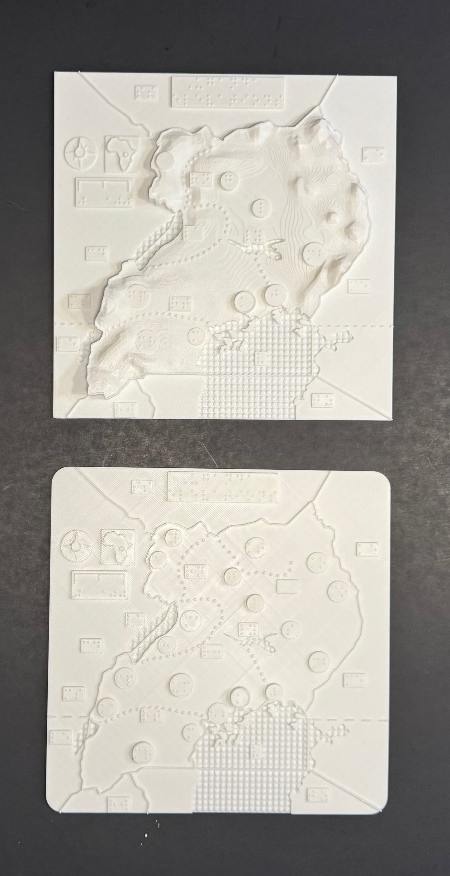
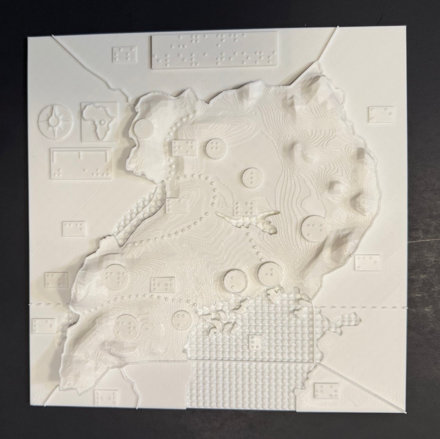
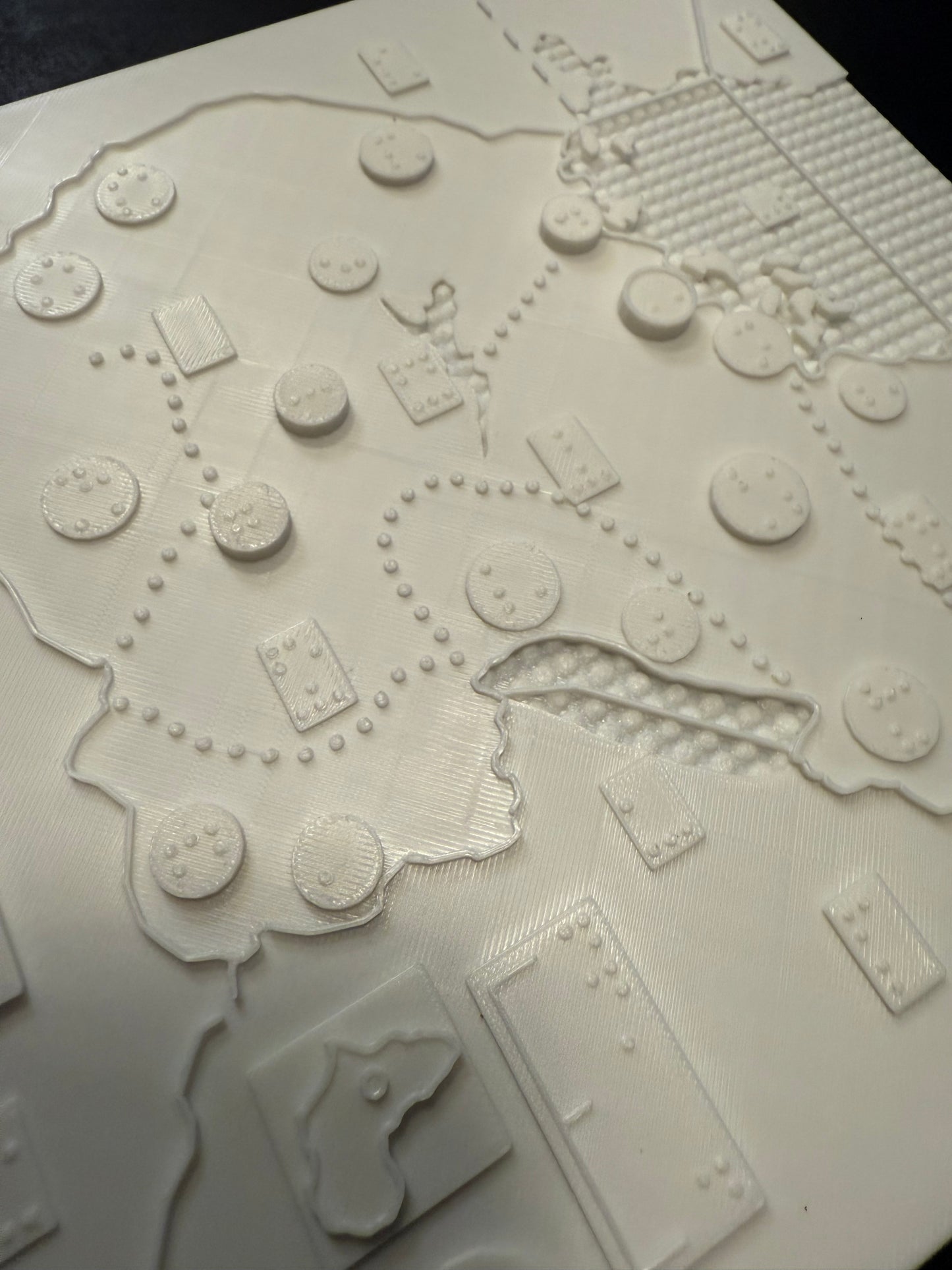
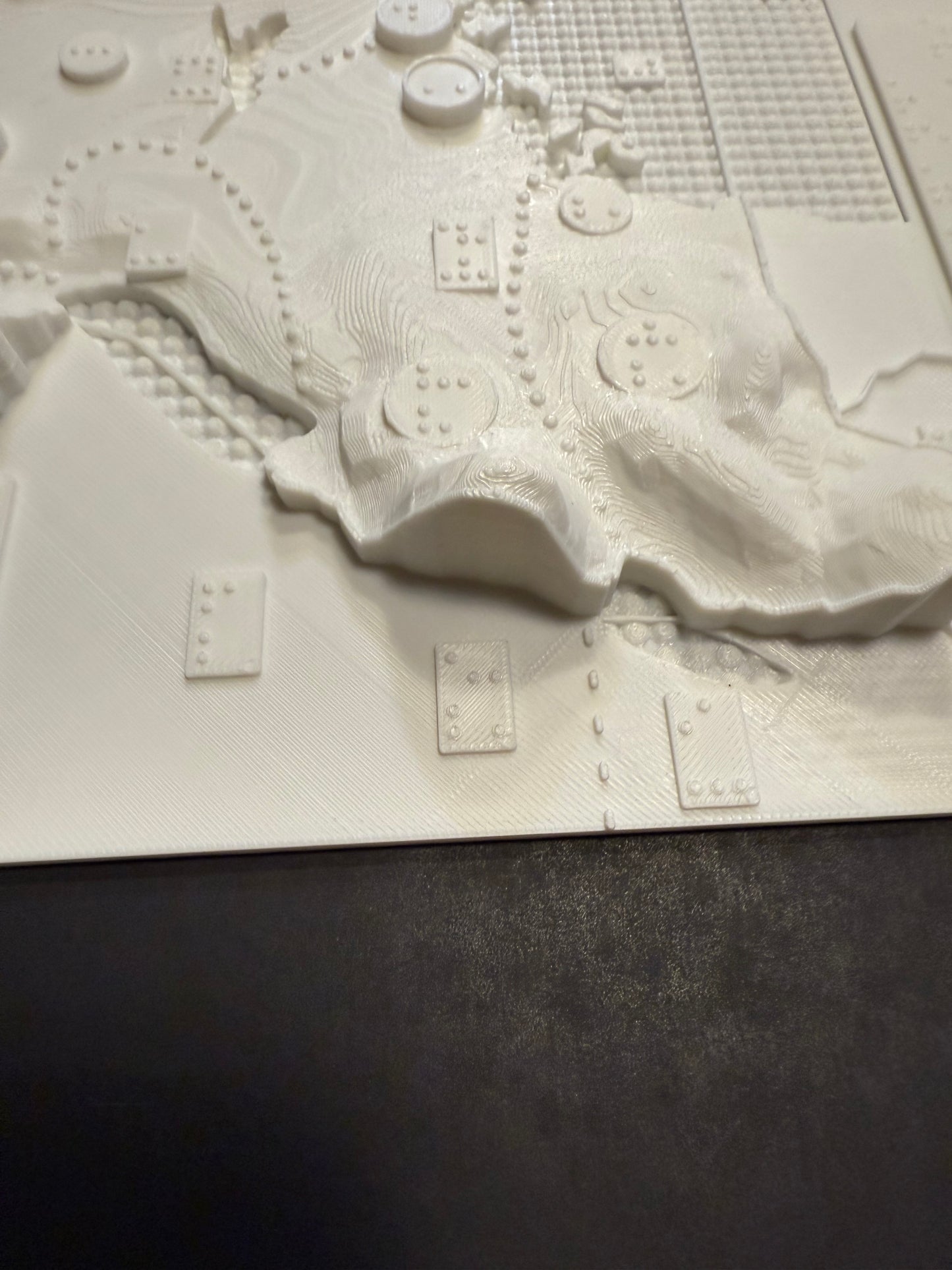
<p>Braille 3D Maps of Uganda – Tactile Set (2 Maps: Elevation & City
Overview) Designed for blind and visually impaired users – fully
tactile, no print</p>
<p>Enhance spatial understanding with this two-map tactile set
representing the country of Uganda, crafted for accessibility, education,
and exploration.</p>
<p>Set Includes two maps and a key:</p>
<ol type=""""1"""">
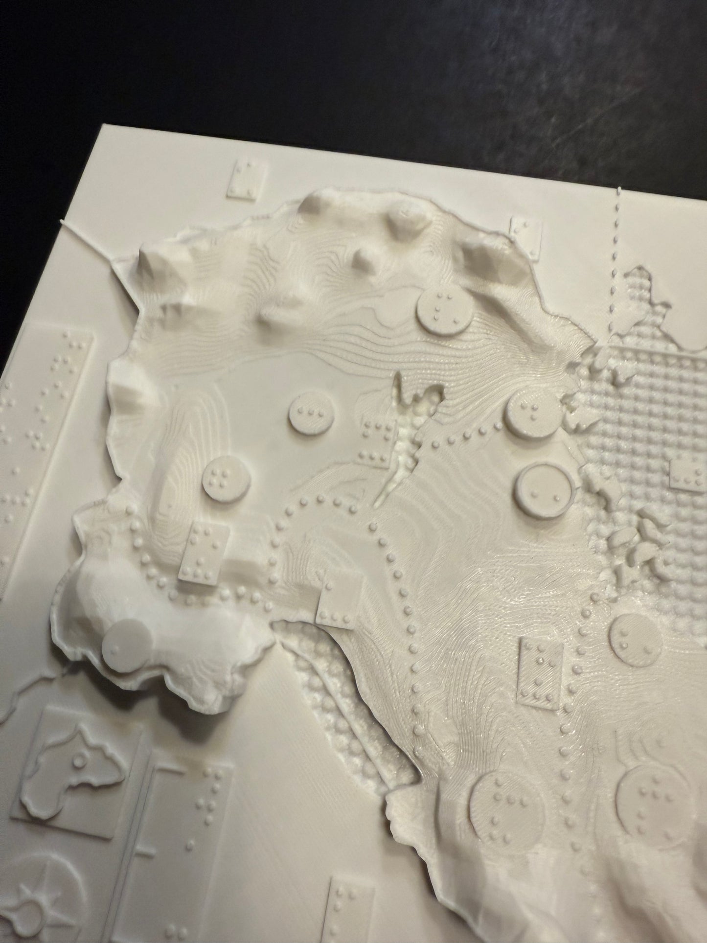
<li>Elevation and Geography Map:</li>
</ol>
<ul>
<li>3D tactile representation of Uganda’s elevations.</li>
<li>Includes raised major cities, rivers, and topographic contours.</li>
<li>Designed to convey changes in terrain across the state.</li>
</ul>
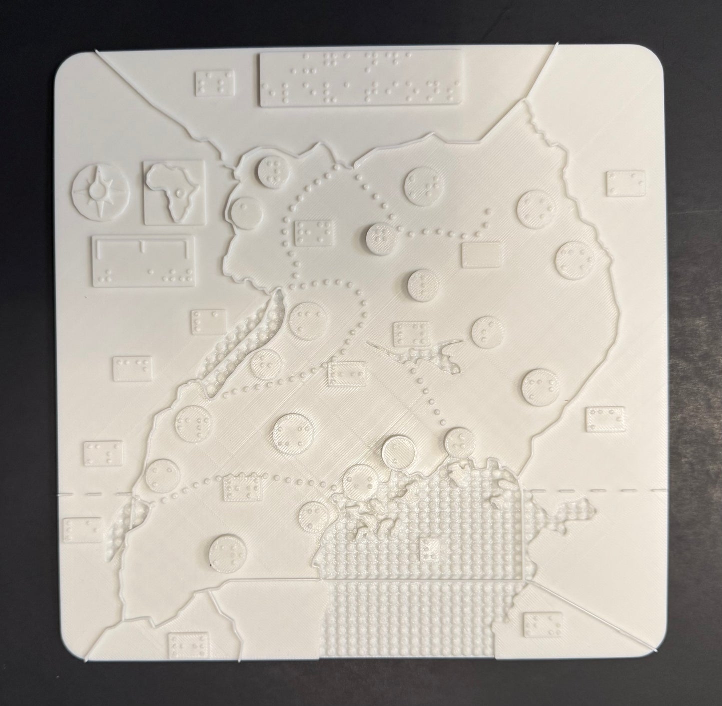
<ol start=""""2"""" type=""""1"""">
<li>City and Waterways Map:</li>
</ol>
<ul>
<li>Detailed map showing Uganda’s cities (including smaller cities not on
the elevation map).</li>
<li>Features lakes and rivers</li>
<li>Smooth, non-elevated background for clearer city and water
detection.</li>
</ul>
<ol start=""""3"""" type=""""1"""">
<li>A braille sheet with map key</li>
</ol>
<ul>
<li>Embossed Braille labels for cities and rivers</li>
</ul>
<p>Ideal for schools, orientation & mobility training, libraries,
and home learning.</p>
<p>Made with high-resolution 3D printing and durable eco-friendly PLA
plastic.</p>
<p>Made in collaboration with the Clovernook Center for the Blind and
Visually Impaired. A portion of proceeds supports educational programs
for blind and visually impaired youth.</p>""</hr>
Share